
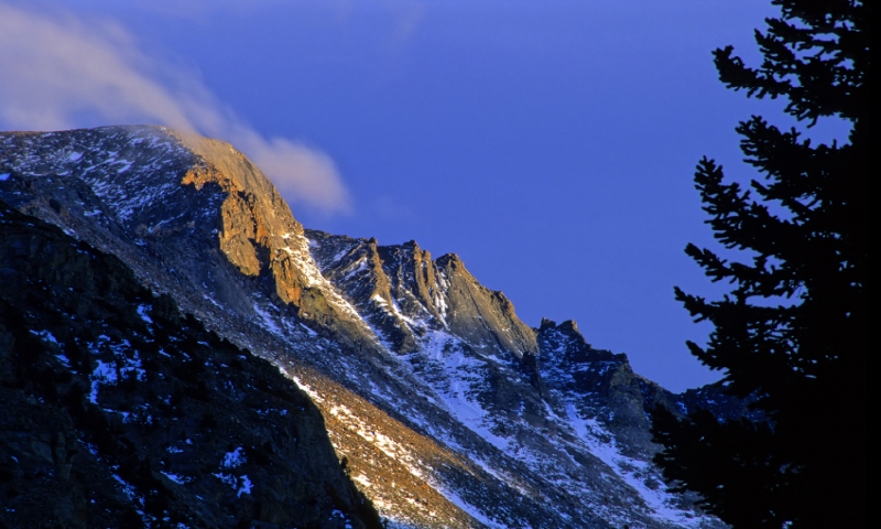

- The Keyhole Route to the summit of Longs Peak is a long, strenuous climb
- The trail is 8 miles one-way with an elevation gain of 4,850 feet
- Best time for hiking this route is from July to mid-September
- The trailhead is one mile west of Colorado Highway 7
Overview
In Rocky Mountain National Park, the most famous mountain in the park, and the tallest, beckons the visitor to ascend its mighty height. Longs Peak provides a strenuous trail to the top, the Keyhole Route. At 8 miles one-way, this trail is a Class III climb, but even though strenuous and challenging, the views from the summit are breathtaking.
Trailhead
Take US Highway 36 into Estes Park and follow it to the junction of Colorado Highway 7. Drive south on Highway 7 to the turnoff for the Ranger Station. From the turnoff, it’s only one mile west to the trailhead.
Details
- Distance – 8 miles
- Average Time of Hike – 6.5 hours
- Elevation Gain – 4,850 feet
- Difficulty – Strenuous
- Trail Type – One-way
Plan & Prepare
Hiking the Keyhole Route means an early start, long before dawn (1 am would be best). Conditions on the mountain are subject to change at any time, particularly in the summer months. Thunderstorms occur in the afternoons, and lightning can be a real risk. Try and reach the peak and get off of the summit before noon.
The best times to come are from July to mid-September. July and August are the peak times for scaling Longs Peak. If coming at this time, try and take this trail on a weekday to avoid the heaviest crowds.
The thin air at this higher elevation requires you to acclimate yourself to the altitude before embarking on your adventure.
