


- Old Fall River Road is a famous one-way ascent up the Continental Divide.
- Bunce School Road has historic sites, and some difficult offshoot climbs
- Escape on Johnny Park Road. Catch views of Longs Peak. Do an out-and-back, loop, or combo with Pierson Park Road.
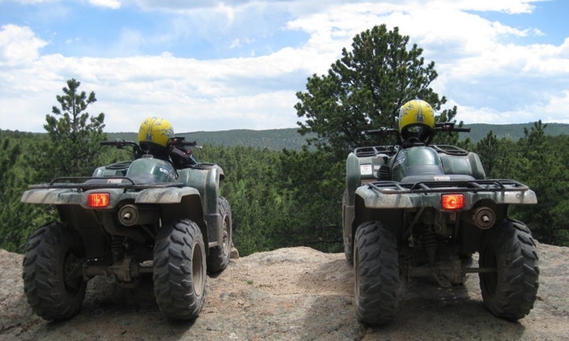
Where can I go ATV/Offroading?
Old Fall River Road
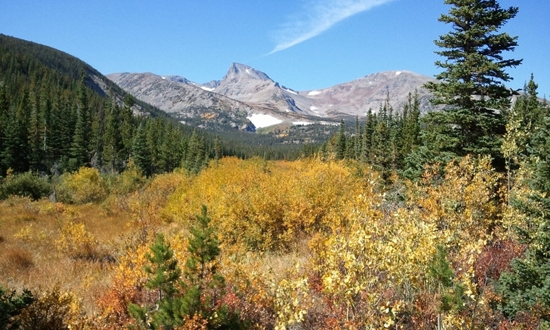
Old Fall River Road is a one-way, uphill road to the top of the Continental Divide. As you ascend, stop at Chasm Falls, lounge at Endo Valley picnic area, and listen to Fall River rush by. Loop back to Estes Park on Trail Ridge Road.
- Directions: Go west on US 34. Enter Rocky Mountain National Park through Fall Entrance. Continue on US 34. Turn right on Old Fall River Road.
- Distance/Time: 11 miles one-way. 2 hours full trip.
- Road Conditions: Easy, dirt road
Bunce School Road
Bunce School Road is popular and easy to get to. It branches off of the Peak to Peak byway, south of Estes Park. As part of the Roosevelt National Forest, the scenery is speckled with wavering Aspens and includes some historic sites.
Start on the road’s north end, where you’ll see the old Bunce School, built in the 1880s. Continue south and detour up a challenging loop called the Ironclads. Further south, another detour leads to the T-33A Plane Crash site.
Bunce School Road ends at Camp Dick, next to Peaceful Valley. Drive back to Estes Park on the Peak to Peak Byway, or return the way you came.
- Directions: Go south on Hwy 7 (St Vrain Hwy), which becomes the Peak to Peak Byway. Pass Allenspark. Turn right at Hwy 72.
- Distance/Time: Bunce School Road is 5.3 miles one-way. If you include side-trips to Ironclads and the T-33 Plane Crash, the trip is around 13.6 miles.
- Road Conditions: Bruce School Road is easy/moderate with mostly smooth dirt and a few rocky sections. Ironclads and T-33 Plane Crash are difficult, extremely steep, and rocky.
Johnny Park Road
Traverse west along Johnny Park Road through Aspen woods and Pine trees, just south of Estes Park. The road climbs higher until you have clear views of Longs Peak and Meeker Mountain.
Stay on the main trail or explore the matrix of offshoot roads.
Continue until you reach the other entrance sign for Johnny Park Road, then return the way you came. Another option is to do a loop through Meeker Park, Johnny Park Road, and back to Estes Park on US 36.
Or, from Meeker Park you can go north on Pierson Park Road. It’s a downhill climb to Estes Park, with fabulous scenery along the way.
- Directions:
Out-and-back: Go southeast on US 36 toward Lyons. Turn right on CR 47. Trailhead will be on your left, and is marked 118A.
Loop: Go south on Hwy 7. Turn left on Cabin Creek Rd (CR 82). Continue past Pierson Park Road. Johnny Park Road will be on your right. Take Johnny Park Road east. Turn right on CR 47, which goes northeast to US 36. Turn left at US 36, back to Estes Park. - Distance/Time: Out-and-back is about 6 miles one-way. 2 hours round trip.
- Road Conditions: Mostly easy, with a few steep climbs, rocks, and puddles.

